Parks and open space, planned properly
PPG17 assessments, green space audits and provision standards: how a local authority learns what its parks are worth.
Open space is one of the few planning subjects where the object of study can be walked, measured and sat in. A local authority assessing its parks and green spaces is not dealing with an abstraction: it is dealing with a patchwork of sites, each with a catchment, a condition, a set of users and a set of problems. The craft of open space planning consists in turning that patchwork into evidence, and the evidence into standards and priorities that can carry weight in development plans and funding decisions.
This craft took much of its modern shape under Planning Policy Guidance note 17, PPG17, which asked local authorities to assess the quantity, quality and accessibility of open space in their areas before setting standards for new provision. A number of studies from that period, including assessments carried out by Ashley Godfrey Associates for Erewash, Harrow, Medway and Mid Bedfordshire, show how the method worked in practice. The approach is traced in more detail in How a PPG17 open space assessment worked, and its later transition into national planning policy is covered in From PPG17 to the NPPF.
What counts as open space
The first task in any assessment is definition. Open space is not one thing but several, and an assessment that treats a municipal park, a churchyard and an allotment as interchangeable will produce findings that nobody can act on. PPG17 assessments typically worked with a typology that separated open space by function, most commonly along these lines:
- Parks and gardens, including urban parks, country parks and formal gardens.
- Natural and semi-natural green space, such as woodland, scrub, grassland, wetlands and former landfill sites restored to informal use.
- Amenity green space, the informal spaces around housing, often owned by landlords or management companies, that provide visual relief and casual recreation close to home.
- Provision for children and young people, from equipped play areas to skateboard parks and informal ball courts. The assessment of this category has its own methods, described in How children's play provision is assessed.
- Allotments and community growing spaces, which carry a distinct statutory history and a distinct set of users.
- Cemeteries and churchyards, which function in part as green space, particularly in dense urban areas where little else exists.
- Civic spaces, squares and market places in town centres.
Cemeteries deserve particular mention because they are so often overlooked. In many towns they are the largest and most mature areas of greenspace within walking distance of homes, valued for quiet recreation and wildlife as much as for their primary purpose. An assessment that excludes them misrepresents what is actually available to residents. The heritage dimension of such sites, and the mapping issues it raises, is discussed in Heritage mapping in open space planning.
Auditing quality and value
Once the sites are classified, each one is visited and scored. PPG17 methodology distinguished between two judgments that are easily confused: quality and value. Quality is a measure of what a site is like, judged against criteria such as the condition of entrances, paths and boundaries; the standard of grounds maintenance; the presence and state of furniture, signage and facilities; and subjective but recorded judgments about cleanliness, safety and enclosure. Value is a measure of what a site does: its level and diversity of use, its role in a network, its ecological or historical significance, its contribution to local character, and whether it provides something that no other site nearby provides.
The distinction matters because it produces four combinations, and each points to a different action. A site of high quality and high value is the core asset to protect. High value but low quality identifies a site worth investing in, because the improvement will be well used. High quality but low value may be a candidate for rationalisation, though only after careful consultation. Low quality and low value may, in some circumstances, be released for other purposes, with any resulting loss offset elsewhere. This fourfold logic is what turns a pile of audit scores into a strategy rather than a list.
The mechanics of site visits, scoring sheets and survey design are set out in Surveys and audits of local provision. Related audit work, particularly on play and sport, is described at Play provision and playing pitches and How a playing pitch strategy is built.
Setting provision standards
Audits describe what exists. Standards describe what should exist. PPG17 was explicit that local authorities should set their own standards, based on local assessment and local consultation, rather than importing national benchmarks. The typical output is a set of standards expressed in three forms: a quantity standard, usually hectares of a type of open space per thousand population; a quality standard, describing the condition sites should reach, often benchmarked against a recognized award scheme; and an accessibility standard, defining the maximum distance residents should have to travel to reach a site of each type, usually expressed as a straight-line or walking-distance catchment.
Applying catchments to a mapped site database shows where provision falls short, ward by ward and neighbourhood by neighbourhood. The method, and its strengths and limitations, are covered in Mapping open space and catchments. Where national points of reference were wanted, the work that Ashley Godfrey Associates undertook with Fields in Trust on benchmarks for different types of play space gave local authorities a yardstick against which to test their own locally determined figures; that work is described in The Fields in Trust benchmarks.
Consultation as evidence
The third leg of the assessment, alongside audit and standards, is the views of residents. Consultation in this field is not a formality: it is the principal means of establishing how sites are actually used, which spaces people value and why, and where they perceive shortage. The methods span quantitative and qualitative work. Postal and online surveys produce numbers that can be compared between groups and areas; well designed questionnaires and careful analysis are what make those numbers trustworthy. Response rates of 35 per cent or more on a lengthy postal survey have been achieved in this work, which is unusual and useful. Focus groups and workshops, including sessions with children and young people and with elected members, uncover the reasons behind the numbers, including from those who do not respond to standard methods.
Done properly, consultation also tests the audit findings. A site scored poorly by a visiting assessor may turn out to be intensively used and locally cherished; a site in good condition may be avoided because of how people reach it. The practice is discussed in Community consultation, done properly, and in the wider context of The craft of planning practice.
From assessment to decision
The PPG17 studies for Erewash, Harrow, Medway and Mid Bedfordshire each ended in the same place: a set of locally justified standards and a strategy that identified deficiencies, protected what mattered and pointed investment where it would count. The national policy framework has since changed, and the current guidance on open space, sport and recreation facilities is published by government at Open space, sports and recreation facilities, public rights of way and local green space. But the underlying method, audit the sites, distinguish quality from value, set standards from evidence, and ask the people who use the spaces, remains the working definition of open space planning done properly. The broader context of policy and application is traced in Land use planning, from policy to application.
All pieces
4 pieces-
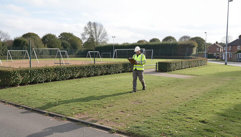
How a PPG17 open space assessment worked
Reviewing plans, auditing every site, scoring quality and value, then consulting residents: the anatomy of an open space study.
Read the piece -
Surveys and audits of local provision
Doorstep surveys, site audits and postal questionnaires: the field methods behind credible open space evidence.
Read the piece -
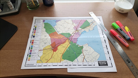
Mapping open space and catchments
Every site on a map, every home in a catchment: how GIS turned open space audits into planning evidence.
Read the piece -
From PPG17 to the NPPF
What changed when national planning policy was rewritten in 2012, and what an open space study still has to prove.
Read the piece